Skip to content

The Front Range Forecast: Thunderstorms, Heavy Rain

In Brief:

Severe weather to our east Thursday, storms and prolonged rain for the weekend.

The Forecast Discussion:

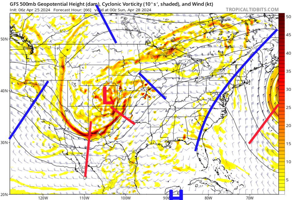
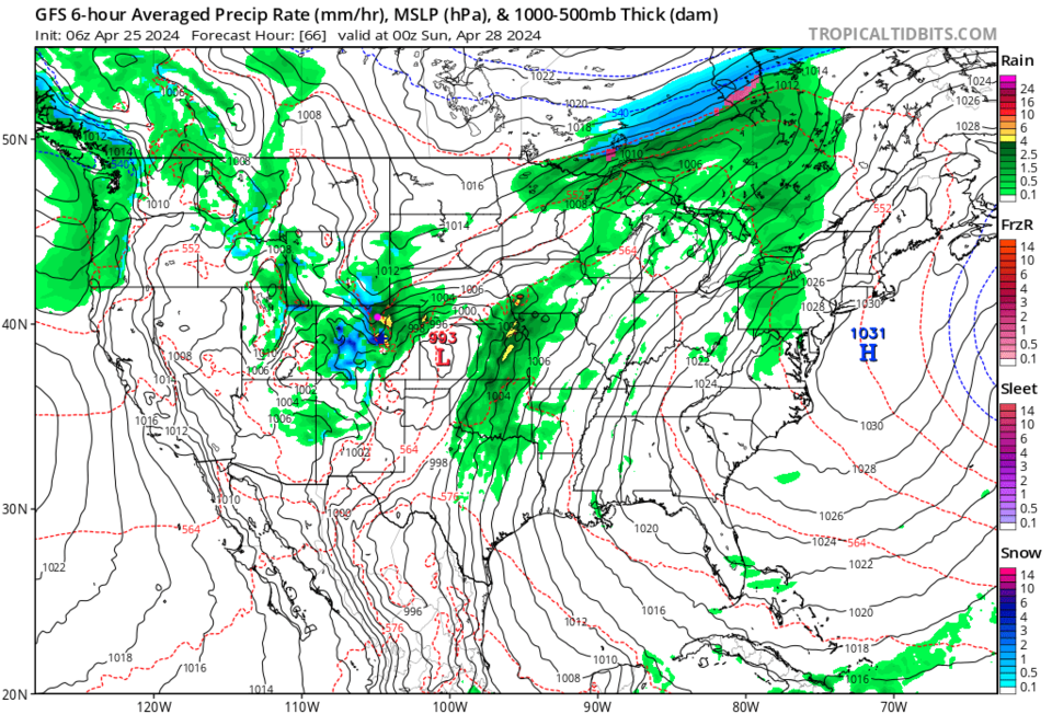
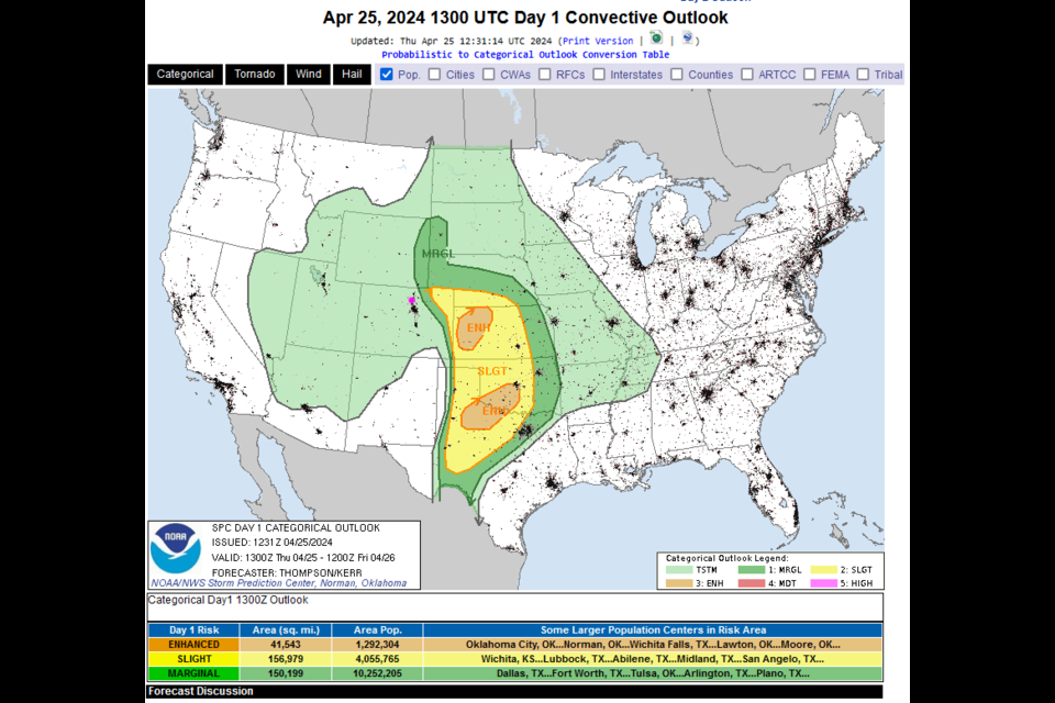
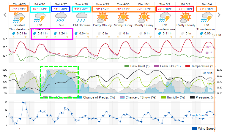
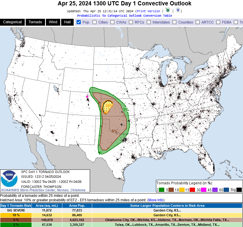
We have one more warm day, Thursday, with moisture streaming into the state. We might see thunderstorms form in the foothills in the early afternoon (Figure 1).  As they move east, they will tap into much deeper moisture and instability. With an approaching upper air low, (to the upper left of the state a day later in Figure 4) they will have the potential to become severe storms just east of I-25 (Figure 2). These storms may even produce isolated tornadoes out on the lains (Figure 3). The weekend will be covered in the Longer Range Forecast below.

figure1_04252024
Figure 1: the 10 day graphical forecast for Longmont from weatherunderground.com
figure2_04252024
Figure 2: the day 1 severe weather forecast map from the SPC.
figure3_04252024
Figure 2: the day 1 tornado risk forecast map from the SPC.

The Longer Range Forecast:

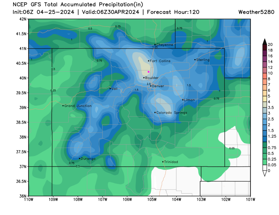
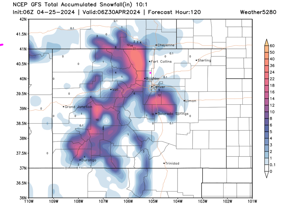
Another, deeper, trough will approach the state for the weekend and cut-off, slowing a lot (Figure 4). It looks like healthy rain rates and snow in the mountain will remain in place from Friday afternoon through Sunday morning (Figure 1 and 5).

Weatherunderground (Figure 1) gives Longmont about 2 inches of liquid. The GFS (Figure 6) is much more bullish. It has a bullseye of 3.5+ rain from central Larimer County to Boulder County. Much of central and northeast Colorado gets 1-2 inches.

Figure 7 shows snowfall.  It is very elevation dependent, picking up rapidly as you climb into the mountains (that is a strong cut-off line!). Places in RMNP may see a foot or two of snow while Estes Park only picks up a few slushy inches. Allenspark might see a foot or more.

We warm up again next week with thunderstorms returning mid-late week.

figure4_04252024
Figure 4: the 500mb upper air forecast map for Saturday evening from the GFS and tropicaltidbits.com
figure5_04252024
Figure 5: the surface precipitation and pressure forecast map for Saturday evening from the GFS and tropicaltidbits.com
figure6_04252024
Figure 6: the 5 day precipitation forecast from the GFS and weather5280.com
figure7_04252024
Figure 7: the 5 day 10:1 snowfall ratio forecast from the GFS and weather5280.com


About the Author: John Ensworth

John Ensworth used to work from Longmont as the PI for the NASA through the IGES (The Institute for Global Environmental Strategies). He now teaches technology, algebra, astronomy, meteorology, film school, and Lego robotics to middle/high school.
Read more


Comments


Current Weather

Mostly cloudy

Mostly cloudy

52°F

UV Index
8 Very High
Pressure
29.52 Rising
Visibility
8 miles
Dewpoint
22 °F
Humidity
31%
Wind
W 12.4 mph
Gust
29.4 mph
Wind Chill
52 °F

Hourly Forecast

Today
1 PM
55°F
Showers
Today
2 PM
56°F
Cloudy
Today
3 PM
57°F
Cloudy
Today
4 PM
57°F
Cloudy
Today
5 PM
56°F
Cloudy
Today
6 PM
55°F
Cloudy
Today
7 PM
55°F
Cloudy
Today
8 PM
53°F
Mostly cloudy
Today
9 PM
51°F
Intermittent clouds
Today
10 PM
49°F
Intermittent clouds
Today
11 PM
48°F
Partly cloudy
Tomorrow
12 AM
47°F
Mostly clear

7 Day Forecast

Showers

Monday

57 °F

Winds becoming strong; a few showers this morning; otherwise, mostly cloudy and cooler


Intermittent clouds

Monday Night

41 °F

Partly cloudy


Partly sunny w/ showers

Tuesday

58 °F

A couple of showers in the morning; otherwise, windy and cool with times of clouds and sun


Partly cloudy

Tuesday Night

33 °F

Partly cloudy


Intermittent clouds

Wednesday

60 °F

Times of clouds and sun


Mostly cloudy

Wednesday Night

38 °F

Increasing clouds


Partly sunny w/ showers

Thursday

56 °F

Times of clouds and sun with a couple of showers; cool


Cloudy

Thursday Night

37 °F

Cloudy


Mostly cloudy

Friday

62 °F

Mostly cloudy and warmer


Mostly clear

Friday Night

36 °F

Mainly clear


Sunrise and Sunset

Sunrise
5:53 AM
Sunset
8:01 PM

Based on AccuWeather data